What Makes a Good Cycling Route? The Secrets to Perfect Ride Planning
 Apr, 16 2026
Cycling Route Quality Scorecard
Rate your planned route based on the criteria below to see if it's a "Vacation Ride" or a "Survival Exercise".
Route Quality Score
The Core Essentials of Rideability
Before you even open a map, you have to define what "good" means for your specific goal. A route for a hardcore climber is a nightmare for a casual commuter. However, some non-negotiables apply to everyone. First, you need to look at the surface. Cycling Route Design is the process of selecting paths that balance rider safety, efficiency, and aesthetic appeal. If you're on a road bike with 25mm tires, a gravel path with loose shale is a disaster. If you're on a mountain bike, a perfectly smooth asphalt track is boring.Surface quality directly impacts your energy expenditure. Rolling resistance on a well-paved road is significantly lower than on packed dirt. For most riders, a "good" route prioritizes smooth, predictable surfaces that minimize the risk of punctures and mechanical failures. When planning, check recent satellite imagery or community forums to see if a path is currently under construction or washed out by rain. A surprise detour through a construction zone is the quickest way to kill the momentum of a great ride.
Safety and Infrastructure: The Invisible Layer
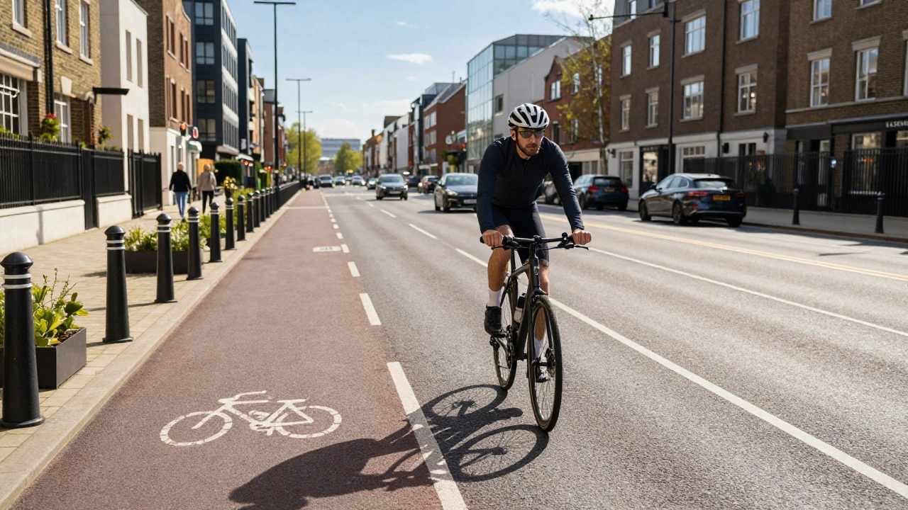
Safety is the baseline. You can't enjoy a scenic view if you're terrified of being rear-ended. The gold standard is Separated Bike Lanes, which are dedicated paths for cyclists that are physically partitioned from motorized vehicle traffic using curbs, bollards, or planters. These reduce the psychological stress of riding and significantly lower the chance of accidents. If separated lanes aren't available, look for "low-stress" streets-roads with lower speed limits, less volume, and more calming traffic measures.Avoid the "death trap" segments. These are typically roads with high speed limits (over 60 km/h) and narrow shoulders. If a route forces you into a high-speed corridor with no shoulder, it's a bad route. A smart planner looks for parallel residential streets or dedicated Greenways, which are linear parks or corridors of greenery specifically designed for pedestrians and cyclists. These paths often cut through the heart of a city while keeping you far away from the exhaust fumes and aggression of main arteries.
| Infrastructure Type | Safety Level | Speed Potential | Stress Level |
|---|---|---|---|
| Separated Cycleway | Highest | High | Very Low |
| Buffered Bike Lane | Medium-High | High | Low |
| Shared Road (Quiet Street) | Medium | Medium | Moderate |
| High-Traffic Arterial | Low | Variable | High |
Mastering the Topography and Flow
Gravity is your best friend and your worst enemy. A route that is completely flat can become monotonous, while one with too many steep climbs can be discouraging for beginners. The secret to a great route is "flow." This means a logical progression of effort. Starting with a gentle warm-up, hitting a challenging climb in the middle, and ending with a rewarding descent is the classic formula for a satisfying ride.When using tools like Strava or Google Maps, don't just look at the 2D line. Switch to the elevation profile. A 10km stretch might look easy on a map, but if it includes a 5% grade for three miles, your legs will feel it. A well-designed route manages the vertical gain so that you aren't exhausted before you reach the best part of the scenery. For group rides, it's vital to match the elevation to the slowest rider's capability to keep the group together and the vibes positive.
The "Reward" Factor: Scenic and Social Hooks
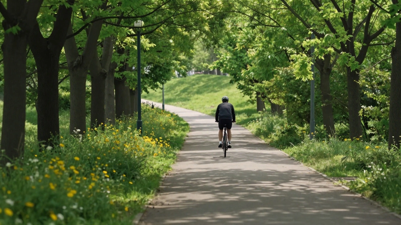
Let's be honest: we don't just ride for the cardio. We ride for the experience. A good route incorporates "rewards." This could be a stunning lookout point, a hidden waterfront path, or a specific bakery that makes the best sourdough in the region. These landmarks act as mental milestones, breaking the ride into manageable chunks. Instead of thinking, "I have 40km left," you think, "I'm only 10km away from that coffee stop." Integrating nature is a huge part of the appeal. Routes that follow rivers, coastlines, or forest trails provide a sensory break from the urban environment. The psychological effect of Biophilia-our innate tendency to seek connections with nature-means that a route through a park will leave you feeling more refreshed than a ride through an industrial estate, even if the distance is the same. When planning, look for "green lungs" in the city-those pockets of parks and reserves that allow you to escape the concrete.
Practical Logistics and the "Forgotten" Details
A route is only as good as its support system. If you're planning a long-distance trek, the placement of water fountains, restrooms, and bike shops is critical. There is nothing worse than running out of water 15km from home in the middle of a heatwave. A professional-grade route includes these "way-points."Consider the wind. If you're riding along a coast, a headwind on the way back can turn a pleasant trip into a grueling slog. The pro move is to plan your route so you face the wind on the way out (while you're fresh) and have it at your back on the way home. Also, consider the timing. A road that is peaceful on a Sunday morning might be a chaotic nightmare on a Tuesday afternoon. A good route is designed for the specific time of day you intend to ride it.
Common Pitfalls to Avoid When Planning
One of the biggest mistakes is trusting a GPS blindly. Just because a map shows a "path" doesn't mean it's rideable. It could be a narrow hiking trail with stairs or a private driveway. Always cross-reference your route with heatmaps-visual representations of where other cyclists actually ride. If a specific street has a thick line of activity, it's probably a safe and pleasant choice. If a "shortcut" looks empty, it's usually for a reason.Avoid "The Loop Trap." While circular routes are convenient, sometimes forcing a loop leads you onto bad roads just to get back to the start. Don't be afraid of "out-and-back" routes or using public transit (like trains with bike racks) to get to a starting point. This allows you to pick the absolute best segments of a region without compromising safety or enjoyment just to close the circle.
How do I find the safest streets for cycling in a new city?
The best way is to use heatmaps from apps like Strava or Komoot. These show you where the majority of cyclists actually go. Additionally, look for municipal "cycling maps" provided by the city council, which usually highlight dedicated bike lanes and suggested low-traffic routes. Always prioritize roads with lower speed limits and a history of cycling activity over the shortest path suggested by a standard GPS.
What is a "low-stress" route?
A low-stress route is one where the cyclist feels safe and comfortable regardless of their skill level. This typically means roads with low vehicle volumes, lower speeds (usually under 30-40 km/h), and physical or visual buffers between the cyclist and the cars. It avoids complex intersections, high-speed arterial roads, and areas with aggressive driving patterns.
Do I need special software to plan a good route?
While you can use a basic map, specialized tools like Komoot, Ride with GPS, or Strava are much better. They provide elevation profiles, surface type information (paved vs. gravel), and community-curated routes. These tools allow you to see exactly how much climbing you'll do and help you avoid unsuitable terrain based on your bike type.
How do I handle elevation when planning for a group?
Plan based on the least experienced rider's capacity. Instead of one massive climb, look for a route with shorter, punchier hills or a steady, gradual incline. Use the elevation profile to identify "recovery zones"-flat sections after a climb where the group can regroup and catch their breath.
What should I do if a planned route is blocked?
Always have a general idea of the surrounding area. If you hit a roadblock, use a heatmap to find the nearest parallel street that is popular with cyclists. Avoid the temptation to take the quickest detour via a main road; instead, loop back to the nearest known safe path, even if it adds a kilometer to your trip.