Best Map for Bike Routes: Top Apps & Tools Compared
 Nov, 9 2026
Cycling App Matchmaker
Answer a few questions about your typical rides to get personalized recommendations for the best cycling map apps.
Select your preferences on the left and click "Find My Best App" to see recommendations.
You’re standing at the trailhead, phone in hand, staring at a blue line that looks like it wants to take you through a shopping center parking lot. Sound familiar? Choosing the best map for bike routes isn’t just about finding a path; it’s about avoiding disaster. You need elevation data that doesn’t lie, surface types that match your tires, and turn-by-turn directions that don’t send you into a wall. With so many apps promising "perfect" routes, how do you actually pick one that works for your specific ride?
I’ve spent years testing these tools across everything from the smooth paths of Sydney’s harbor to the rough gravel of the Blue Mountains. The truth is, there is no single "best" app for everyone. It depends on whether you’re commuting, touring, or chasing KOMs. But by understanding what each platform actually does under the hood, you can stop guessing and start riding with confidence.
Understanding What Makes a Cycling Map Different
Before downloading anything, you need to know why a standard car GPS fails cyclists. A road network optimized for cars ignores one-way restrictions for bikes, misses pedestrian-only zones where bikes are allowed, and completely overlooks dedicated cycleways. For a cyclist, a "route" is defined by three critical attributes: Surface Type, the physical material of the path such as asphalt, gravel, or dirt, Elevation Profile, the vertical gain and loss over the distance which dictates effort levels, and Legal Accessibility, whether local laws permit bicycle use on that specific path.
If an app doesn’t explicitly filter for these, it’s just a fancy road map. The best cycling maps integrate OpenStreetMap (OSM) data, which is community-driven and often more up-to-date regarding new bike lanes than proprietary corporate maps. They also provide "rideability" scores, telling you if a path is technically feasible for your bike type. A mountain biker needs different data than a commuter on a hybrid bike. Recognizing this distinction saves you from ending up on a staircase when you meant to be on a rail trail.
The Heavyweights: Strava and Komoot
When people ask for the best map, they usually mean one of two names: Strava, a fitness tracking social network known for segment leaderboards and route building and Komoot, a navigation app focused on detailed outdoor activity planning with strong surface analysis. These two dominate the market, but they serve slightly different psychological needs.
Strava’s strength lies in its massive user base. Its "Popular Segments" feature shows you where other cyclists have ridden. If thousands of people rode a specific forest path last week, it’s probably open and safe. However, Strava’s native routing engine has historically been criticized for sending riders onto busy roads. To fix this, you often need to manually tweak routes using their map editor, dragging points away from main arterials. It’s great for validation-seeing what others do-but less intuitive for discovering new, quiet backroads automatically.
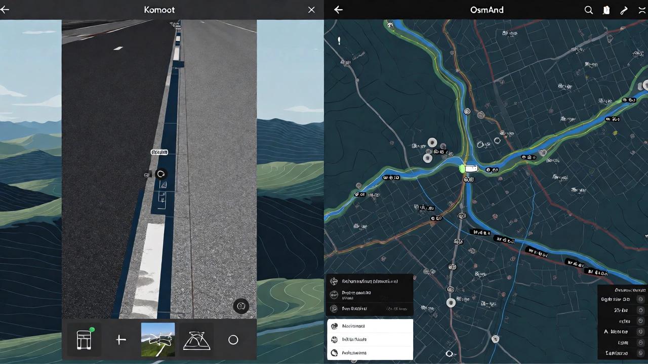
Komoot, on the other hand, treats route planning as a puzzle. When you draw a line, it analyzes the surface. It will tell you, "This section is 40% gravel." If you set your profile to "Road Bike," it will avoid that section entirely. If you switch to "Gravel Bike," it might include it. This granular control makes Komoot superior for adventure cycling and touring. It integrates seamlessly with Garmin devices, allowing you to download routes for offline use without fiddling with file transfers. For serious explorers, Komoot’s ability to highlight "Highlights"-like scenic viewpoints or historic bridges-adds value beyond mere navigation.
OpenStreetMap Powerhouses: OsmAnd and Organic Maps
If you hate subscription fees and want total control, look toward apps built directly on OpenStreetMap (OSM), a free editable map of the world created by volunteers. Two standout options here are OsmAnd, a powerful offline map application with extensive customization options and Organic Maps, a lightweight, privacy-focused map app based on OSM data.
OsmAnd is the Swiss Army knife of mapping. It’s ugly, complex, and incredibly powerful. You can toggle specific layers: show only bike-friendly roads, hide highways, display contour lines for elevation, and even load custom GPX files. It stores maps locally on your device, meaning it works perfectly in remote areas with zero signal. The learning curve is steep, though. Setting up a "Bicycle" profile requires navigating through dozens of settings. But once configured, it’s unbeatable for long-distance touring where data roaming costs matter. Organic Maps offers a simpler experience. It’s faster, cleaner, and uses less battery. While it lacks some of OsmAnd’s deep customization, it provides excellent basic routing for city commutes and casual weekend rides without the clutter.
Specialized Tools for Serious Touring: RideWithGPS
For those who plan multi-day trips, RideWithGPS, a premium route planner offering advanced features like live location sharing and course management remains a gold standard. Unlike consumer apps, RideWithGPS focuses on precision. Its "Smart Routing" allows you to specify preferences like "avoid tolls," "prefer quiet streets," or "maximize climbing." It calculates estimated time of arrival based on your average speed, helping you plan rest stops accurately.
The real killer feature here is LiveTrack. During a solo tour, family members can watch your progress in real-time. If you stop moving unexpectedly, they get an alert. This safety net is invaluable when riding in unfamiliar territory. Additionally, RideWithGPS supports "Courses," which are pre-planned loops that you can follow exactly, rather than just getting general direction instructions. This prevents accidental detours during high-speed descents where reading a screen is dangerous.
| Feature | Strava | Komoot | OsmAnd | RideWithGPS |
|---|---|---|---|---|
| Primary Strength | Social validation & segments | Surface analysis & discovery | Offline capability & customization | Precision & safety tracking |
| Cost Model | Freemium (Subscription for full features) | Freemium (One-time purchase for regions) | Free / One-time unlock | Subscription-based |
| Offline Maps | Limited (Premium required) | Excellent (Downloadable regions) | Full local storage | Yes (Premium) |
| Bike Specificity | Moderate (Often defaults to roads) | High (Surface-aware routing) | High (Customizable profiles) | High (Advanced filters) |
| Learning Curve | Low | Moderate | High | Moderate |
How to Choose Based on Your Riding Style
Selecting the right tool comes down to matching features to your behavior. Are you a daily commuter in a dense city? You need reliability and traffic awareness. Strava or Google Maps (with cycling mode enabled) might suffice because you already know the area. You just need to know if a lane is closed today. In this case, real-time data matters more than detailed topography.
Are you an explorer looking for new trails on weekends? Komoot is likely your best bet. Its ability to suggest "Top Tours" nearby helps break routine. You can see photos taken by other users at specific waypoints, giving you a preview of the scenery before you commit to the ride. This visual confirmation reduces the risk of disappointment.
Planning a cross-country trip? Prioritize offline functionality and battery efficiency. OsmAnd or Organic Maps shine here. You can download entire states or countries in advance. Check your phone’s battery usage stats; some apps drain power quickly due to constant GPS polling. OsmAnd allows you to adjust GPS frequency, extending battery life significantly during long days in the saddle.

Common Pitfalls and How to Avoid Them
Even the best map can fail if used incorrectly. One common mistake is trusting the "shortest route" option blindly. Algorithms often choose the most direct geometric path, which might involve steep hills or unpaved tracks unsuitable for your bike. Always check the elevation profile before hitting start. A 10km route with 500m of climb is vastly different from a 10km flat loop.
Another pitfall is outdated data. Cycle lanes change. A path marked as "under construction" six months ago might now be a finished masterpiece. Cross-reference multiple sources. If Strava shows heavy recent activity on a path, it’s likely usable. If OSM shows it as "abandoned," trust the crowd-sourced recent data over the static map layer. Finally, never rely solely on audio cues while riding. Visual confirmation of turns is safer. Use a handlebar mount to keep the screen visible, reducing neck strain and reaction time.
Practical Tips for Better Route Planning
- Start with a seed: Don’t start from scratch. Find a popular route on Strava or Komoot that matches your desired length, then modify it. Adding your own twists is easier than building from zero.
- Check surface warnings: In Komoot, red icons indicate poor surfaces. If you’re on a road bike, avoid them. If you’re on a gravel bike, embrace them.
- Plan for water and food: Use map markers to pin cafes or public taps. Most cycling apps allow adding custom POIs (Points of Interest). Do this before leaving home to avoid scrambling for resources mid-ride.
- Test your sync: Before a big trip, ensure your phone syncs correctly with your bike computer (Garmin, Wahoo, etc.). A failed transfer means riding blind.
The "best" map is ultimately the one you’ll actually use consistently. Complexity leads to abandonment. If you find yourself fighting the interface every Sunday, switch to something simpler. Technology should enhance the ride, not distract from it. By combining the social insights of Strava, the surface intelligence of Komoot, and the offline reliability of OsmAnd, you create a robust toolkit that handles any scenario.
Is Strava better than Komoot for route planning?
It depends on your goal. Strava is better for seeing what others ride and validating popular routes. Komoot is better for discovering new routes and analyzing surface types (gravel vs. asphalt) before you go. For pure planning accuracy regarding terrain, Komoot generally wins.
Can I use these maps offline?
Yes, most top apps offer offline capabilities. Komoot lets you download regions for a one-time fee. OsmAnd and Organic Maps store maps locally for free or low cost. Strava requires a premium subscription to save routes for offline use. Always download maps while connected to Wi-Fi before heading out.
Which app is best for mountain biking?
Komoot is highly recommended for mountain biking because it distinguishes between technical trails, fire roads, and singletrack. It also provides difficulty ratings. OsmAnd is also excellent if you customize it to show hiking/biking trails specifically, but it requires more setup.
Do I need a paid subscription?
Not necessarily. Organic Maps is free and very capable. OsmAnd offers a free version with limited downloads, but a one-time payment unlocks unlimited maps. Strava and Komoot have free tiers, but key features like advanced routing or offline maps often require payment. Evaluate if the extra features justify the cost for your riding frequency.
How accurate is the elevation data?
Elevation accuracy varies. Apps using barometric pressure sensors (like on some phones or watches) are more accurate than those relying solely on GPS data. Komoot and RideWithGPS typically pull from high-resolution digital elevation models, providing reliable estimates. However, minor discrepancies of 10-20 meters can occur in dense urban areas or deep valleys.